The stream network visualization is made possible by a collaboration between ESRI, ECMWF, and BYU. The color and width of the lines which represent the stream segments are determined by the average of the ensemble streamflow prediction run by the hydrologic model. Wider lines means more flow and the coloring represents if the stream is experiencing a return period level event: blue = normal, yellow = exceeds 2 year return period, red = exceeds 10 year return period, and purple = exceeds 20 year return period.
Like all models, the GEOGloWS ECMWF model needs to be calibrated. Calibration becomes increasingly difficult as a model increases in geographic extents, complexity, temporal range of simulation, and the frequency the model is executed. The difficulty increases because both the computation time and amount of required input and validation data increases. In the case of hydrologic models, sufficient streamflow observations often do not exist, are not shareable, or are too inaccurate or incomplete to be used. Researchers at BYU led by Jorge Luis Sanchez Lozano, Riley Hales, and Jim Nelson, are developing alternate methods to calibrate models on the fly using what observed data exist and various techniques rooted in spatial analysis, statistical reasoning, and machine learning. These gauge networks represent countries where observed discharge is available as a service and this research team has been performing case studies. Click on one of the reds dots (representing a gauged stream location) to retrieve the streamflow model results for that location after applying a calibration algorithm using the observed data.
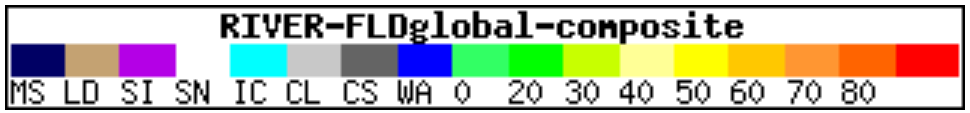
VIIRS imagery is a web mapping service layer derived from optical observations from satellites.
VIIRS Flood Detection Map Quick Guide (PDF) (noaa.gov)